Frontal Himalayan topographic studies
Currently, I am working on a project that uses topographic analysis, Optically Stimulated Luminescence (OSL) dating on fluvial terraces, and pebbles lithology distribution.
Topographic analysis
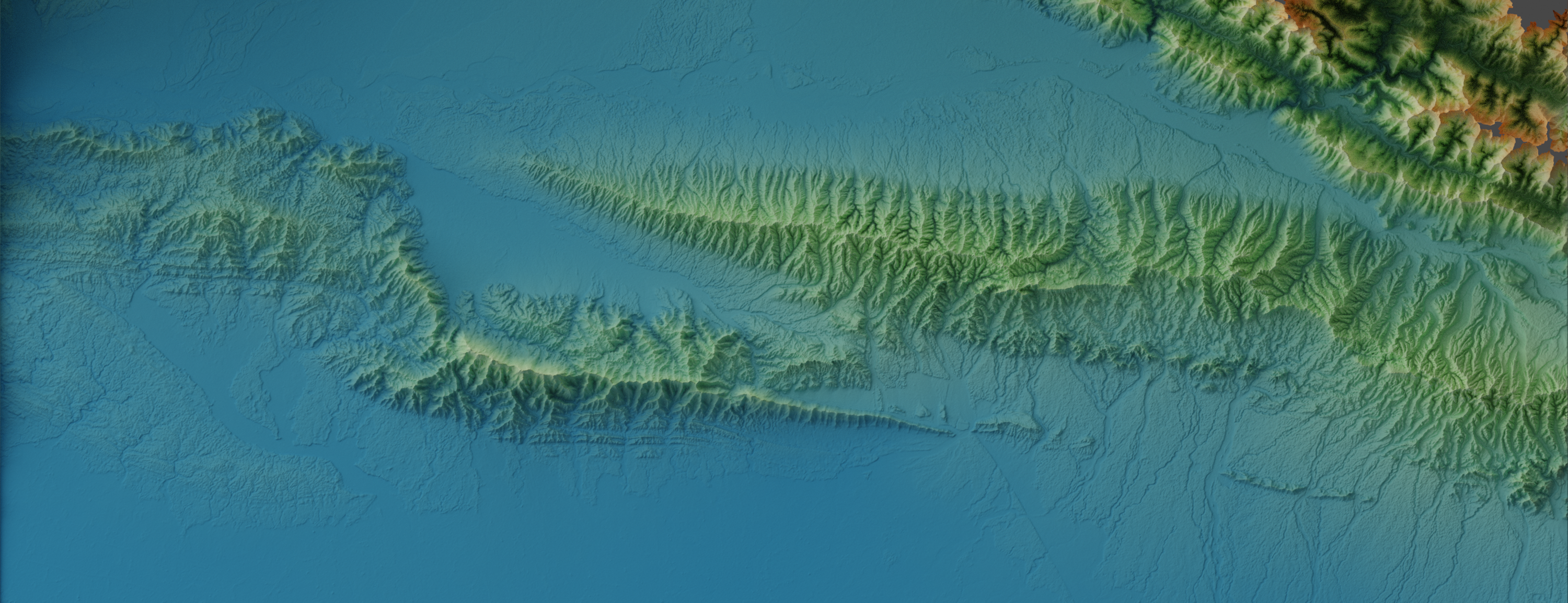
I used the ALOS PALSAR 12.5 metre resolution DEM to obtain the spatial channel steepness (ksn), knickpoint distribution, and channel concavity (θ) on three thrust fold ranges in the frontal Himalaya. I compared the results of these metrics with the tectonic shortening amount across the three ranges. It demonstrates that the characteristics of those parameters developed with the increasing amount of shortening. Here is a talk from me about my current project:
OSL and fluvial network analysis
The purpose of the OSL dating on my research project is generally to reveal the fluvial network evolution of Chitwan Dun (a piggyback basin which formed due to thrusting in the frontal Himalaya), in Nepal. The measurement of the pebble’s lithology distribution is also to reveal the fluvial network evolution in the Chitwan Dun. Constraining the fluvial network evolution in Chitwan Dun is important since most rivers are mainly deflected by the growth of faults. Hence, the development of fault propagation motion can be understood. However, the main purpose of the OSL dating is to constrain the rate of uplift in the Churia range (one of the thrust fold ranges in which the topography I analysed). The Churia range itself is a ‘wedge-shaped’ uplifting ridge formed by the fault-propagating fold induced by the activity of the Himalayan Main Frontal Thrust (MFT). There is no uplift rate information along the Churia range, and therefore, constraining the uplift rate in this area is crucial since it is situated right next to a heavily populated area. Aside from that, I also measured a sediment log in the outlet channel of the Chitwan Dun, which is situated near the MFT. The log measurement records a mass flow deposit followed by a ponding event and a channel succession. This information could tell us an earthquake event, which then induced a landslide and block the river. I also took two samples of OSL to constraint the timing of the event. It will give a better understanding of the fault’s behaviour in the future.